The Nomads Outdoors Group Inc.
Powered by
Past events
All events
Past events

Mar
07
2025
Past Event
Labour Day Long Weekend – ChillOut Camping
Jubilee Lake Holiday Park & Cafe
07 Mar 2025 18:00 – 10 Mar 2025 16:00
We’ll use the Jubilee Lake Holiday Park as our base for a relaxed weekend doing some walks in the Daylesford region whilst also participating in ChillOut Festival.
GRADE: Social - this is a base camp for participating in events during the ChillOut Festival.
ACTIVITY DESCRIPTION: There are many events you can attend as part of ChillOut Festival, and the Nomads have also organised a number of walks to coincide with it. The Jubilee Lake Holiday Park is a great base for your ChillOut long weekend. This park is a little out of the centre of Daylesford, but much nicer and less crowded than the caravan park beside the ChillOut Carnival site.
Some activities to consider attending include:
Saturday 10am: The Nomads ChillOut Saturday Morning Community Walk.
Saturday evening: BYO barbecue at the Jubilee Lake Park, and/or many ChillOut events around town.
Sunday: Attend the ChillOut Festival Street Parade then either head to the ChillOut Carnival, do the Nomads Naturist walk, relax at the camp or attend any of the other events around town.
Sunday 1:30pm: The Nomads Daylesford Naturist Walk during ChillOut.
Sunday evening: We'll once again organise an evening meal at the Spice of India Restaurant, within easy walking distance of the Jubilee Lake Holiday Park.
Monday 10:50am: On the way back to Melbourne, do the Lyonville-Newbury Circuit Walk – Labour Day.
BOOKING: by Tuesday 4th March or ASAP. To register, click on Get Tickets to get a ticket for EACH NIGHT you wish to camp.
Do not book your accommodation directly with the holiday park!
Get a MEMBER or VISITOR ticket for EACH NIGHT you wish to camp. You need to log in as a financial Nomads member to take out a Member ticket.
Visitors who wish to attend any of the other Nomads events over the weekend, are advised to take out a 1 month temporary membership (cost $8) prior to making any bookings. You can then book free member tickets for the events you want to attend (though the camping fee remains the same: $17 per person per night).
Everybody (Members and Visitors): Don't forget to also register for any other events you wish to attend.
Unsure if you've already booked? Click View my bookings.
MEETING TIME | LOCATION: 6-10pm on Friday 7th March at the Jubilee Lake Holiday Park, Daylesford (or as arranged with the leader). The leader will provide additional details after you register.
MAP REFERENCE: Google map goo.gl/maps/cXKMzKvqni22.
DISTANCE | TIME FROM GPO: Via Western Fwy 118 km, 1 hour 30 minutes | via Calder Fwy 117 km, 1 hour 35 minutes.
PUBLIC TRANSPORT:
V/LINE: There is a regular V/Line service between Melbourne and Daylesford. If using that, contact the leader to see if we can collect you from the bus stop (outside the CFA Station in central Daylesford).
LIFT: If you would like a lift between Melbourne and Daylesford, when you book your camping ticket(s) answer YES to the "Do you need transport to the event" question (and give your suburb), and the leader will try to arrange a lift for you.
SHUTTLE BUS: ChillOut will be operating a shuttle bus again, running every 30 minutes until 1am between Jubilee Lake, central Daylesford and Hepburn Springs - cost $20 for a weekend bus pass.
TAXI: Daylesford normally has a good taxi service (03 5348 1111), but no Ubers. Taxis are likely to be hard to come by on this busy weekend though.
ACCOMMODATION: The Nomads “base camp” will be a cluster of five unpowered camp sites. The sites are reasonably large and can each accommodate a number of people (in multiple tents or small camping vehicles) per site. Cars can generally be parked on or beside the sites, with additional parking available in the car park near reception.
COST: The Nomads have pre-booked the sites - you don't need to book individually! The cost is $17 per person per night.
FOOD: There are BBQ facilities and a cafe at the holiday park. Alternatively, you can bring your own food for the weekend and/or dine in Daylesford.
APPAREL & EQUIPMENT: You will need to BYO tent and bedding unless you're able to share somebody else's. A chair and table are handy, but not essential. A torch is essential.
LEADER: Alan D. | Email LeaderAlanD@nomads.org.au if you have any questions.
Members can access leader contact details under Members | Leader Contacts when logged in to the website.
HOME BACK TO LIST OF EVENTS MEMBERSHIPS

Mar
04
2025
Past Event
Social Night - Mt View Hotel
Mt View Hotel
19:00 – 21:00
Our regular monthly social night - this month at the Mt View Hotel.
GRADE: Social.
ACTIVITY DESCRIPTION: The Nomads hold a social night each month, where members and guests can enjoy a meal, talk about upcoming events, compare notes on past activities and float ideas on events they would like to see run. New members are especially invited to attend the monthly Nomads social evenings. We'll meet in the rooftop bar, which has great views of the CBD skyline. See mtviewhotel.com.au for further details and the menu.
BOOKING: By Sunday 2nd March. To register, click on Get Tickets.
Unsure if you've already booked? Click View my bookings.
MEETING TIME | LOCATION: 7pm | Mt View Hotel, 68-70 Bridge Rd, Richmond - Rooftop Bar.
MAP REFERENCE: Google map goo.gl/maps/E7uvkw4KKwaVTD5w5.
PUBLIC TRANSPORT: Tram #48 (via Collins St) or #75 (via Flinders St) to stop 15.
LEADER: Garry O. | Email LeaderGarryO@nomads.org.au if you have any questions.
Members can access leader contact details under Members | Leader Contacts when logged in to the website.
HOME BACK TO LIST OF EVENTS MEMBERSHIPS
Mar
02
2025
Past Event
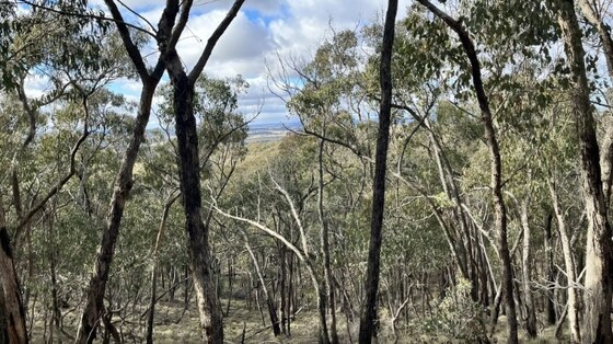
Fryers Ridge Circuit Walk
Taradale
11:00 – 15:00
A circuit walk northwest of Melbourne, near Taradale (Castlemaine).
GRADE | LENGTH | TYPE: Grade 2: Moderate 10 km circuit walk (graded according to the AWTGS: Australian Walking Tracks Grading System).
ACTIVITY DESCRIPTION: A great track through the Fryers Ridge Nature Conservation Reserve in central Victoria, located in between Castlemaine and Kyneton. This looped route begins at the ends of the national park on Fryerstown Road in the town of Taradale. The trail itself is along 4WD tracks which are rarely used by vehicles. Enjoy making your way through the bushland, catching occasional views of the surrounding lowlands.
The track can get muddy after rain, so be sure to set out with good footwear if there's been recent rainfall.
BOOKING: By Friday 28th February. To register, click on Get Tickets.
Unsure if you've already booked? Click View my bookings.
MEETING TIME | LOCATION: 11am at Saltwater Track, Fryerstown-Taradale Road, Taradale.
PUBLIC TRANSPORT: Public transport is not feasible.
MAP REFERENCE: Google map: maps.app.goo.gl/Yx9htZuiaWCNHHELA
FOOD: Carry lunch, snacks and a litre of water.
APPAREL | FOOTWEAR: Comfortable walking boots and dress according to the weather forecast.
LEADER: Richard C. | Email LeaderRichardC@nomads.org.au if you have any questions.
Members can access leader contact details under Members | Leader Contacts when logged in to the website.
HOME BACK TO LIST OF EVENTS MEMBERSHIPS
Mar
01
2025
Past Event
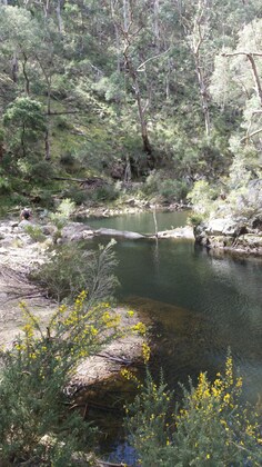
Mixed Naturist Walk to the deep Lerderderg River Valley
10:30 – 16:30
This event has been shifted from Sunday 16th Feb due to cold wintry weather forecast for that day.
This walk is for naturists. Enjoy a clothes free walk into a remote section of the Lerderderg River to find a pleasant waterhole and possible swim, near an old gold mine. A choice of two return routes. A challenging walk 1 km along the river boulders and up a steep return track. Or if you prefer, return on the easier but still steep track used to come in to the river.
GRADE | LENGTH | TYPE: (graded according to the AWTGS: Australian Walking Tracks Grading System):
Option 1: Grade 3: medium to hard 9 km circuit walk on steepish tracks and a 1 km rocky section along the river.
Option 2: Grade 2: approx 6 km medium walk in and out on the same track, on a reasonably good, but steepish walking track.
ACTIVITY DESCRIPTION: We will meet in Lohs Lane for a short catch up at 10:30am. There is no food or drinks available here, sorry. If you'd like coffee, you will need to get it in Bacchus Marsh which is 20 km and 20 mins before the Lohs Lane meeting place.
Once packed with minimal gear, and sunscreen on exposed skin, we will head off past one country house and the Mt Blackwood summit, 600m above sea level, along a pleasant walking track down towards the river. Once past the house, we can totally strip off, complete our sunscreen application and continue on down to the river. The river is a good spot for lunch and a swim. The group taking the challenging river walk and steep return trip will head off first after lunch. The group returning on the easier route can take off about 45 mins later, so that we can all meet at a track junction on the way home and then all return to the cars together.
AFTERNOON DRINKS AND SNACKS: If we'd like a cool drink or coffee and some snacks after our walk, we can drive back to a hotel in Bacchus Marsh. The particular hotel and address will be advised later.
BOOKING: Preferably by Thursday 13th February. To register click on Get Tickets.
Unsure if you've already booked? Click View my bookings.
MEETING TIME | LOCATION: 10.30am in the car park at 89 Lohs Lane, Myrniong, 3341. The car park is at the eastern end and 1 km along Lohs Lane. Lohs Lane is a public road. If you come across a closed wire gate, open the gate, drive through and then close it after you. If the gate is open just leave it open.
MAP REFERENCE: Google map maps.app.goo.gl/Dee8PRkD9xxKi2Es9.
DISTANCE | TIME FROM GPO: 81 km, approximately 1 hour 10 minutes via Western Fwy. Once past Bacchus Marsh take the Myrniong exit. At the end of the exit ramp turn right towards Myrniong. After about 1 km turn right onto Mt Blackwood Rd. (The turn is easty to miss as it's on a sharpish left hand turn!) Turn right into Lohs Lane which is 6.8kms from the start of Mt Blackwood Rd.
PUBLIC TRANSPORT: There is no public transport. Contact the leader to see if he can arrange a lift for you.
FOOD: Carry lunch, snacks and a litre of water.
APPAREL | FOOTWEAR: Comfortable walking boots/shoes, sunscreen, sunhat, sunglasses. A small towel could be handy if the waterhole is deep enough to swim in. Shorts will be required until we get past the one and only house. The forest is quite thick providing good shade, and is very sheltered from any wind. However the weather can be variable from very hot and sunny, to quite cool. Take contingency clothing as
appropriate.
LEADER: Russell W. | Email LeaderRussellW@nomads.org.au if you have any questions.
Members can access leader contact details under Members | Leader Contacts when logged in to the website.
HOME BACK TO LIST OF EVENTS MEMBERSHIPS
Feb
23
2025
Past Event
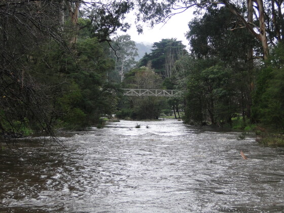
Dee River via Rail Trail and O'Shannassy Aqueduct
Warburton Waterwheel Visitor Information Centre
10:30 – 16:30
Dee River via Rail Trail and O'Shannassy Aqueduct is full of beautiful scenery and is a terrific way to explore Warburton and the surrounding region. The Wurundjeri People are the original custodians of this land.
Most of the trail sits inside the Yarra Ranges National Park and starts from Warburton Waterwheel Visitor Information Centre where there is ample parking available. The path travels beside both Yarra and Dee Rivers and follows O'Shannassy Aqueduct Trail. There is some on-road walking. The surrounding flora adds to the magical backdrop of this trail as does the birdlife. The path winds through lush ferns and tall forests brimming with crimson rosellas, kookaburras and many other species.
GRADE | LENGTH | TYPE: Grade 3:- Medium (hilly terrain) 13 km circuit walk, with an elevation gain of 396 metres (graded according to the AWTGS: Australian Walking Tracks Grading System).
ACTIVITY DESCRIPTION: This is a nice walk along the Yarra river at Warburton, then the well established rail trail to Millgrove with a turn to the north up to the Aqueduct. Head east along the aqueduct for about 4 km with some nice views over Warburton Valley and then back to town down the Mt Victoria Track.
BOOKING: By Thursday 20th February. To register click on Get Tickets.
Unsure if you've already booked? Click View my bookings.
FURTHER INFORMATION: O'Shannassy River | Yarra Ranges National Park
MEETING TIME | LOCATION: 10:30am at the Warburton Waterwheel Visitor Information Centre (ample free parking) - 3400 Warburton Hwy, Warburton VIC 3799.
MAP REFERENCE: Melway map 290 grid B4 | Google map goo.gl/5PTF2b1VBGYHAMJG9
DISTANCE | TIME FROM GPO: 75 km, approximately 1 hour 33 minutes via various metropolitan roads to connect up to the Warburton Highway at Wandin.
PUBLIC TRANSPORT: Not feasible for the start of the event as the first Sunday bus (via Lilydale train station) does not arrive until well after 11am.
FOOD: Carry lunch, snacks and 2 litres of water.
APPAREL | FOOTWEAR: Comfortable walking boots/shoes and dress according to the weather forecast. Warburton can be a touch cooler than Melbourne.
LEADER: Garry Oliver | Email LeaderGarryO@nomads.org.au if you have any questions.
Members can access leader contact details under Members | Leader Contacts when logged in to the website.
HOME BACK TO LIST OF EVENTS MEMBERSHIPS

Feb
16
2025
Past Event
Postponed to Sat 1st March. Mixed Naturist Walk to the deep Lerderderg River Valley
10:30 – 16:30
This event has been postponed to Saturday 1st March due to wintery cold weather forecast for Sun 16th Feb.
This walk is for naturists. Enjoy a clothes free walk into a remote section of the Lerderderg River to find a pleasant waterhole and possible swim, near an old gold mine. A choice of two return routes. A challenging walk 1 km along the river boulders and up a steep return track. Or if you prefer, return on the easier but still steep track used to come in to the river.
GRADE | LENGTH | TYPE: (graded according to the AWTGS: Australian Walking Tracks Grading System):
Option 1: Grade 3: medium to hard 9 km circuit walk on steepish tracks and a 1 km rocky section along the river.
Option 2: Grade 2: approx 6 km medium walk in and out on the same track, on a reasonably good, but steepish walking track.
ACTIVITY DESCRIPTION: We will meet in Lohs Lane for a short catch up at 10:30am. There is no food or drinks available here, sorry. If you'd like coffee, you will need to get it in Bacchus Marsh which is 20 km and 20 mins before the Lohs Lane meeting place.
Once packed with minimal gear, and sunscreen on exposed skin, we will head off past one country house and the Mt Blackwood summit, 600m above sea level, along a pleasant walking track down towards the river. Once past the house, we can totally strip off, complete our sunscreen application and continue on down to the river. The river is a good spot for lunch and a swim. The group taking the challenging river walk and steep return trip will head off first after lunch. The group returning on the easier route can take off about 45 mins later, so that we can all meet at a track junction on the way home and then all return to the cars together.
AFTERNOON DRINKS AND SNACKS: If we'd like a cool drink or coffee and some snacks after our walk, we can drive back to a hotel in Bacchus Marsh. The particular hotel and address will be advised later.
BOOKING: Preferably by Thursday 13th February. To register click on Get Tickets.
Unsure if you've already booked? Click View my bookings.
MEETING TIME | LOCATION: 10.30am in the car park at 89 Lohs Lane, Myrniong, 3341. The car park is at the eastern end and 1 km along Lohs Lane. Lohs Lane is a public road. If you come across a closed wire gate, open the gate, drive through and then close it after you. If the gate is open just leave it open.
MAP REFERENCE: Google map maps.app.goo.gl/Dee8PRkD9xxKi2Es9.
DISTANCE | TIME FROM GPO: 81 km, approximately 1 hour 10 minutes via Western Fwy. Once past Bacchus Marsh take the Myrniong exit. At the end of the exit ramp turn right towards Myrniong. After about 1 km turn right onto Mt Blackwood Rd. (The turn is easty to miss as it's on a sharpish left hand turn!) Turn right into Lohs Lane which is 6.8kms from the start of Mt Blackwood Rd.
PUBLIC TRANSPORT: There is no public transport. Contact the leader to see if he can arrange a lift for you.
FOOD: Carry lunch, snacks and a litre of water.
APPAREL | FOOTWEAR: Comfortable walking boots/shoes, sunscreen, sunhat, sunglasses. A small towel could be handy if the waterhole is deep enough to swim in. Shorts will be required until we get past the one and only house. The forest is quite thick providing good shade, and is very sheltered from any wind. However the weather can be variable from very hot and sunny, to quite cool. Take contingency clothing as
appropriate.
LEADER: Russell W. | Email LeaderRussellW@nomads.org.au if you have any questions.
Members can access leader contact details under Members | Leader Contacts when logged in to the website.
HOME BACK TO LIST OF EVENTS MEMBERSHIPS
Feb
08
2025
Past Event
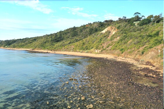
Mixed Naturist beach day at Sunnyside North - with optional dinner at Frankston
Sunnyside North Beach
11:00 – 17:00
A leisurely day at the beach. This is a mixed event. Everybody is welcome.
GRADE | LENGTH | TYPE: Grade 2: Easy, social day with short walks along the beach (graded according to the AWTGS: Australian Walking Tracks Grading System). Some rocks to walk over to get from the carpark to the naturist beach.
ACTIVITY DESCRIPTION: Enjoy a leisurely day sunbaking, walking, swimming and socialising with other Nomads on the beach. Sunnyside North Beach is the only officially designated clothing optional beach on Port Phillip Bay, and the closest legal naturist beach to Melbourne.
Sunnyside North Beach is a very popular beach with naturists from all over Melbourne and beyond, for very good reasons. It is a safe beach, easy to get to, and offers good swimming and general beach fun. There are a number of rocky areas and reefs close to shore which may also provide snorkelling opportunities if you wish. Most of the beach is sandy with scattered small rocks. This is a family friendly beach, so behaviour needs to be appropriate at all times.
The naturist beach is a very popular location on any sunny day, and the car parking spaces closest to the beach fill up quickly. Arrive early if you would like the best chance of a close park. Car parking is free and untimed all day. Be careful to follow all parking signs to avoid a parking fine.
We strongly suggest not leaving valuables visible in your car, which of course is good practice everywhere. And, as is common sense, do not leave anything unattended on the beach.
In the main beach carpark (Sunnyside Beach - clothed) are several modern individual toilets and outdoor showers, but once we move to the clothing optional beach, there are no facilities at all. You need to be self-sufficient and bring your own food and drink, esky, sun shelter or wind protection if desired, sunscreen, sunnies and hat. Clothing must be worn between the carpark and the beach. Also, we recommend suitable footwear to protect your feet from the sometimes sharp rocks along the short walking track to the beach. The leader will bring a beach shelter which can be used as a communal place to keep small items out of the direct heat of the sun, and as a focal point for our group once on the beach.
We will gather towards the Northern end of the main carpark at the end of Sunnyside Road at 11am. If you arrive late, no problem, just follow the rocky track north until the next sandy beach, you will have no problem locating and joining our group.
Low tide at Sunnyside North Beach will be at 10.15am (though it's not very low), and high tide is forecast for 3.00pm.
You are free to do as much or as little as you want on the beach, it is your day, so make the most of it. There is no planned finishing time, you are free to spend as much or as little time as you wish on the beach.
If the weather forecast for the day is determined as unsuitable by the leader, this beach day may be cancelled, or alternatively may be changed to the following day. Any changes in event details due to adverse weather or other reason will be made to the Nomads event listing no later than 8pm on the evening prior to the event. If no changes to the event details by 8pm, the beach day will go ahead as planned and there is no need to check further.
This is a free event, but to assist with planning, it is requested that you register your attendance. We look forward to seeing as many of you as possible on this naturist beach day.
OPTIONAL FOOD OR DRINKS AT RESTAURANT IN FRANKSTON
If you would like to extend the social atmosphere of the beach day a bit further, we are planning to make a group booking for about 12 people at a nice restaurant in Frankston commencing at 5pm. The booking is at Iron River Bar and Grill, 437 Nepean Highway, Frankston.
Frankston is approximately a 20 minute drive from the carpark at Sunnyside Beach. Attendance is entirely optional, but due to the popularity of the venue, we would need to confirm numbers as early as possible on the day. If we require more seats reserved for us, a change of booking at the restaurant can be requested, but there are no guarantees, as they are often fully booked.
If you think that you might like to come along for food or drinks after the beach day, please contact the leader via the link in this event information. No obligation, just helps with planning.
BOOKING: Preferably by Thursday, 6th February 2025. To register to attend, click on Get Tickets (no charge for this event).
Unsure if you've already booked? Click View my bookings.
FURTHER INFORMATION: www.melbourneplaygrounds.com.au/sunnyside-beach-mount-eliza#.XVd7kOgzZPY.
MEETING TIME | LOCATION: 11am at the Northern end of the main beach carpark at the end of Sunnyside Rd, Mt Eliza.
MAP REFERENCE: Melway map 104 grid K5 | Google map goo.gl/maps/ggsox7nN4KDiCa5z9.
DISTANCE | TIME FROM GPO: 66 km, 1 hour 10 minutes via M1 and M3 | 79 km, 1 hour 20 minutes via M3.
PUBLIC TRANSPORT: From Flinders Street Station, catch the 8:23am Frankston train to Frankston, arriving at 9:28am. The 785 bus departs from Bay D at Frankston Station at 9:40am. Get off at the George Vowell Institute Blind/Nepean Hwy, Mt Eliza at 9:55am. From there it is a 1.3 km walk to the Sunnyside Beach car park. Alternatively, contact the leader, who may be able to arrange car sharing for you.
FOOD: Lunch, snacks, plenty of water/drinks as there are no local facilities immediately available.
LEADER: Michael J. | Email the Leader if you have any questions.
Members can access leader contact details under Members | Leader Contacts when logged in to the website.
HOME BACK TO LIST OF EVENTS MEMBERSHIPS
Feb
04
2025
Past Event
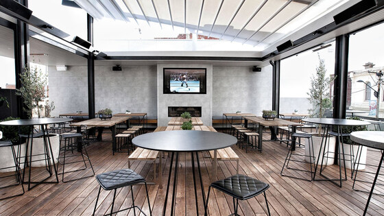
Social Night - Railway Hotel, Yarraville
Railway Hotel
19:00 – 21:00
** Nomads email addresses have changed to the format LeaderFredN@nomads.org.au, and may go into your Junk Folder as a result. See Some Recommendations about Nomads Emails to prevent that **
Our regular monthly social night - this month at the Railway Hotel Yarraville.
GRADE: Social.
ACTIVITY DESCRIPTION: The Nomads hold a social night each month, where members and guests can enjoy a meal, talk about upcoming events, compare notes on past activities and float ideas on events they would like to see run. New members are especially invited to our social nights as an orientation to Nomads activities.
Tuesday night is Parma Night at the Railway Hotel Yarraville - $20 parmas. Or you can order from their regular rooftop menu.
BOOKING: By Sunday 2nd February. To register, click on Get Tickets.
Unsure whether you have booked? Click View my bookings.
MEETING TIME | LOCATION: 7pm at the Railway Hotel, 35 Anderson St, Yarraville.
MAP REFERENCE: Google map maps.app.goo.gl/3MCzTaxUBDxkxzbe8.
PUBLIC TRANSPORT and PARKING: The Railway Hotel is less than 100m from Yarraville Station, on the Werribee and Williamstown lines.
LEADER: Garry O. | Email LeaderGarryO@nomads.org.au if you have any questions.
Members can access leader contact details under Members | Leader Contacts when logged in to the website.
Image: Pubspy
HOME BACK TO LIST OF EVENTS MEMBERSHIPS

Feb
02
2025
Past Event
The Nomads at 2025 Midsumma Pride March
Ian Johnson Oval
09:30 – 16:00
Officials Have Moved The Start Time of the Pride to 10:30 AM - 30 Minutes earlier due to the weather forecast of 37 degrees MAX Temperature on Sunday.
Gather your family and friends together, and your Nomads polo shirt, and head along to Fitzroy St, St Kilda to march with The Nomads in the annual Midsumma Pride March.
GRADE | TYPE: Grade 1: Easy, social (graded according to the AWTGS: Australian Walking Tracks Grading System). Contact the Event Leader if you wish to purchase a NOMADS Polo shirt (sizes from SX up to XXL).
ACTIVITY DESCRIPTION: Come along to march with us, or cheer us on from the sidelines.
The best view of the parade is always from within it though, so register via Get Tickets to join The Nomads in marching proudly down Fitzroy Street.
See the Midsumma Pride March event for details of "do's and don'ts" such as staying hydrated, sun protection, etc. Closer to the date, registered participants will receive an email from the NOMADS with instructions, such as our position in the march and time to arrive at the Ian Johnson Oval.
BOOKING: By Friday 30th January. To register, click on Get Tickets.
Unsure if you've already booked? Click View my bookings.
MEETING TIME | LOCATION: probably from 9:30am onwards - we will be notified of our assembly time closer to the event | Ian Johnson Oval, Fitzroy St, St Kilda.
MAP REFERENCE: Google map goo.gl/maps/rNZFmL1Pz16aCqD18.
PUBLIC TRANSPORT: Tram #12 to stop 143 | Tram #96 to stop 132 | any St Kilda Rd Tram to stop 30 (these tram stops will be serviced even while the march is proceeding) and Bus #246 along Punt Rd/Barkly St to the Princes St/Barkly St bus stop.
LEADER: Garry O. | Email LeaderGarryO.nomads.org.au if you have any questions.
Members can access leader contact details under Members | Leader Contacts when logged in to the website.
Image: Zack M.
HOME BACK TO LIST OF EVENTS MEMBERSHIPS
Feb
01
2025
Past Event
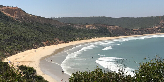
SouthSide Naturist Beach Day with optional dinner
Southside Beach
11:00 – 20:30
New meeting time of 11am! But you can go to the beach beforehand!
Details have been emailed to those registered as of 11:30am 31/01/25. If you are registering after this, I will send you the details during the day!
This event is for naturists. Enjoy a pleasant clothes-free beach day, enjoying games, swimming and socialising. An optional naturist beach hike during the day with an optional chinese dinner at a local restaurant is also on offer.
GRADE | LENGTH | TYPE: Grade 2: Easy, approximately 400m walk from the car park to the beach (graded according to the AWTGS: Australian Walking Tracks Grading System). There is a ramp down to the beach which is rather steep in parts. Beach walk is graded 2: easy subject to tides.
ACTIVITY DESCRIPTION: Enjoy a pleasant clothes-free beach day, with a leisurely lunch and swim. Optional activities include body surfing in a moderate surf and a 1 km beach walk to the rocky headland towards Southside. As the tide will go out during the day, we could, if you like, walk around the headland for another kilometre to the very end of the naturist beach at Pt Addis. A beach game or two will also be enjoyed.
At the conclusion of the walk, there will be an optional cliff top walk followed by dinner at a local Chinese restaurant in Torquay.
BOOKING: By Friday 31st January. To register, click on Get Tickets.
Unsure if you've already booked? Click View my bookings.
MEETING TIME | LOCATION: 10:30am at SouthSide car park. Google "Southside car park" for the exact location. If you arrive later, you can meet us on the beach proper. Instructions will be emailed prior to the event on the exact spot if you wish to join later.
MAP REFERENCE: Google map maps.app.goo.gl/DaoEh41aTQkm5U5N6.
DISTANCE | TIME FROM GPO: 107 km, approximately 1 hour 20 minutes to drive via the M1 freeway.
PUBLIC TRANSPORT: The Apollo Bay coach has a stop at Pt Addis Rd, from Geelong but it is strongly encouraged not to use public transport. Carpooling is an option for those without a car, please make your own arrangements. Contact the leader well in advance if you do not have a nominated driver to see if a driver can be arranged.
FOOD: Bring lunch, snacks and drinking water. There are no kiosk facilities at the beach.
APPAREL | FOOTWEAR: Sunscreen, hat, repellent, beach towel, footwear if the sand is hot. Shorts required to get from the car park to the appropriate clothing option section of the beach. Beach umbrella or shade equipment could be useful as there is limited shade at the beach.
LEADER: Jason T. | Email LeaderJasonT@nomads.org.au if you have any questions.
Members can access leader contact details under Members | Leader Contacts when logged in to the website.
HOME BACK TO LIST OF EVENTS MEMBERSHIPS
Jan
27
2025
Past Event
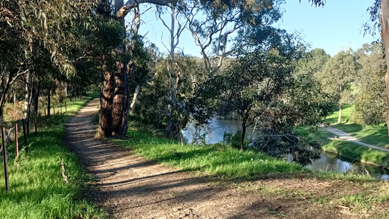
Midsumma Community Walk: Discover Inner Yarra Regeneration
Hawthorn Station Car Park
10:30 – 15:30
An interesting ramble to explore little known paths along the Yarra River in Melbourne's inner east and north. This event is part of the 2025 Midsumma Festival.
GRADE | LENGTH | TYPE: Grade 2: Easy 7 km walk on sealed and packed-gravel paths (graded according to the AWTGS: Australian Walking Tracks Grading System). There are only minor undulations.
ACTIVITY DESCRIPTION: The environs along the inner east and north of the Yarra River have undergone multiple regenerations since European settlement. This one-way walk from Hawthorn to Abbotsford, on unsealed and sealed paths, demonstrates past and current associations with the River. Many public transport options are available to and from the walk. Registration is essential.
BOOKING: By Saturday 25th January, or ASAP to ensure you don't miss out. To register click on Get Tickets.
Unsure if you've already booked? Click View my bookings.
MEETING TIME | LOCATION: 10:30am in the car park of Hawthorn Station, Evansdale Rd, Hawthorn.
MAP REFERENCE: Google map maps.app.goo.gl/nTpBdXKTwmWJjwh68.
PUBLIC TRANSPORT:
Train: Lilydale, Belgrave or Alamein lines to Hawthorn Station
Tram: #75 to Hawthorn Station or #48 to stop 23 (Burwood Road / Church Street)
FOOD: BYO water bottle, snacks and lunch.
APPAREL | FOOTWEAR: Wear a hat, sunscreen and closed footwear.
LEADER: Garry O. | Email LeaderGarryO@nomads.org.au if you have any questions.
Members can access leader contact details under Members | Leader Contacts when logged in to the website.
HOME BACK TO LIST OF EVENTS MEMBERSHIPS
Jan
26
2025
Past Event
Australia / Rum Rebellion Day at Blanchfields 26 January
12:00 – 16:00
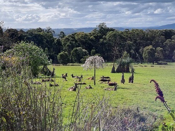
Enjoy a casual picnic on Sunday 26 January on the property of a Macclesfield member, which includes a swimming pool, expansive outdoor picnic area, historic features and some delightful walking trails.
GRADE | LENGTH | TYPE: Social - picnic with optional camp out overnight at "Blanchfields", a private home overlooking the Yarra Valley.
ACTIVITY DESCRIPTION: We are very privileged to be invited to a picnic in the private and beautiful gardens of the home of member Robert A. It is a rural property with a large garden of exotic trees and shrubs, grasslands and some bushlands overlooking the Yarra Valley. Robert has also invited guests to stay the night after the day of revelry if you wish. You are welcome to set up your tents or trailers in the gardens and leave the next day. In that case, Robert will direct you where you can set up camp.
The event starts from midday onwards. There are a limited number of chairs and tables as well as a toilet and bathroom for use. Note – this is not a barbeque. Fires are not allowed in a high fire danger area. Enjoy the swimming pool and stay over in your tent or camper if you wish. There will be access to the oven/stove if anything needs cooking or heating up. Plus, the vegetable garden should be in full production if we need additional ingredients. Updates will follow closer to the date. There will be a short walk around the property later in the afternoon.
BOOKING: by Thursday 23rd January. To register, click on Get Tickets.
Unsure if you've already booked? Click View my bookings.
MEETING TIME | LOCATION: From midday onwards at the private home of member Robert A., located in Macclesfield (past Emerald). Address will be forwarded once you have booked a ticket.
MAP REFERENCE: Google map goo.gl/maps/KBZiiJpW2uj.
DISTANCE | TIME FROM GPO: 1 hour – about 60 km.
TRANSPORT: No public transport. Travel by car and carpool with someone else if you can. Take the Monash or Eastlink Freeway and exit at Wellington Rd then continue to Macclesfield. The full address and travelling directions will be provided to you upon receipt of your RSVP.
FOOD: Bring your own food and drink. For those staying the night, there will be shared drinks, nibbles and meal on the deck at sunset. Until we know how many will be taking part, let’s just call it a “potluck dinner”, any contributions gratefully received.
APPAREL | FOOTWEAR: Bring your own hat, sunscreen and insect repellent. Dress according to the weather forecast.
LEADER: Robert A. | Email LeaderRobertA@nomads.org.au if you have any questions.
Members can access leader contact details under Members | Leader Contacts when logged in to the website.
HOME BACK TO LIST OF EVENTS MEMBERSHIPS